A few notes on the differences between data gathered by the 1233 and 5100 ASLM scanners
by Ramón Arrowsmith, August 2006
Updated September 18 to correct shot density maps, add link to Kim, et al., 2006 and show search radius scenarios.
In the B4 surveys (Bevis, et al.), a part of the southeastern Carrizo Plain (along the Dragon's Back Pressure ridge--Arrowsmith, 1995) was scanned by both the Optech 1233 and 5100 ALTM systems. A question arose about comparing the datasets. A portion of these data is available at: ftp://pipeline.gps.caltech.edu/pub/Archive/project_data/B4/1233_v_5100/
We also have the 5100 data on line in the Geon Lidar Workflow (http://www.geongrid.org/science/lidar.html
Here is an excerpt from the readme:
5100
Pulse rate 70 KHz
Scan frequency 45 Hz
Scan angle +\- 19.5 degrees (processed)
5 flight strips
600 M above ground (nominal)

1233
Pulse rate 33 KHz
Scan frequency 28 Hz
Scan angle +\- 19.5 degrees (processed)
600 M above ground (nominal)
Processing
Introduction
The shot density in ALSM data is so high that most of what we do is not interpolation but local binning to produce Digital Elevation Models (DEM). In collaboration with UC San Diego colleague Han Kim, we have just implemented a new local gridding method which computes the minimum (Zmin), mean (Zmean), and maximum (Zmax) elevations within a specified search radius for each grid node in the DEM. Here is our AGU abstract in pdf form: AGU_Fall_Meeting_Abstract_final. Here are some notes I wrote up as part of the development: Notes_on_Lidar_interpolation. Here is a figure that shows the search radius as a function of grid resolution: searching.gif.
In the examples below, I ran it with a 1 meter search radius and computed a 1 meter DEM and 0.25 m search radius to compute a 0.25 m DEM. In addition, and very important for our assessment of the data, we can compute the point density (shots per square meter in this case).
1233 data
There are 11,308,722 data
points in the 1233 cloud on the ftp site (even though most of the files had incomplete
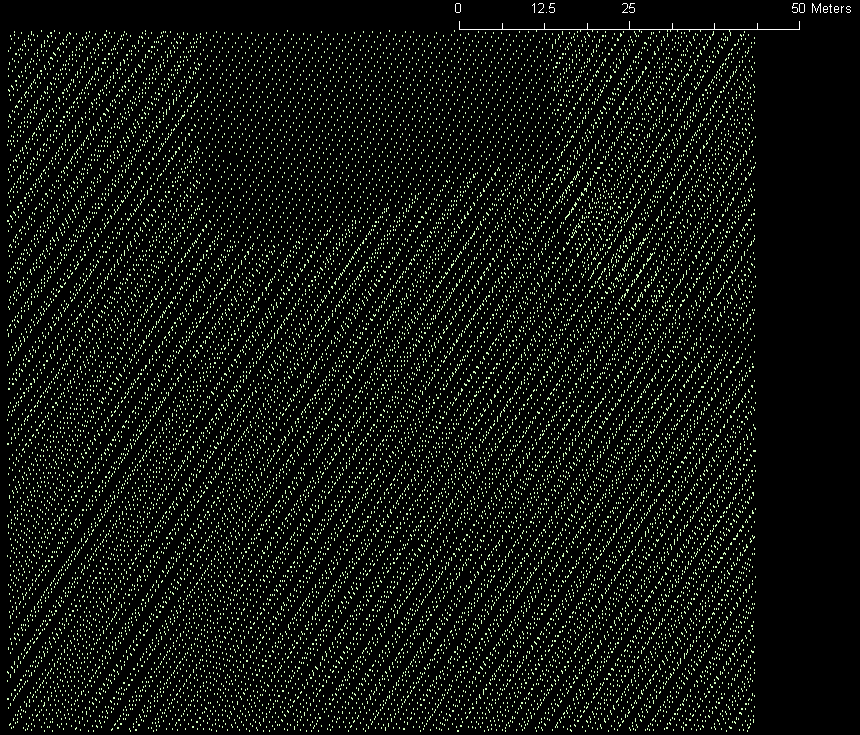
final lines) in 8 files (Str_57--Str_65). Figure 1 shows the pattern of the 9 flight swaths. The total width is about 1850 m. Each swath is about 420 m wide.
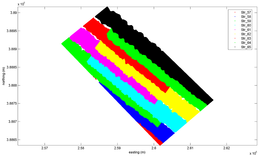
Figure 1. 1233 point cloud coverage.
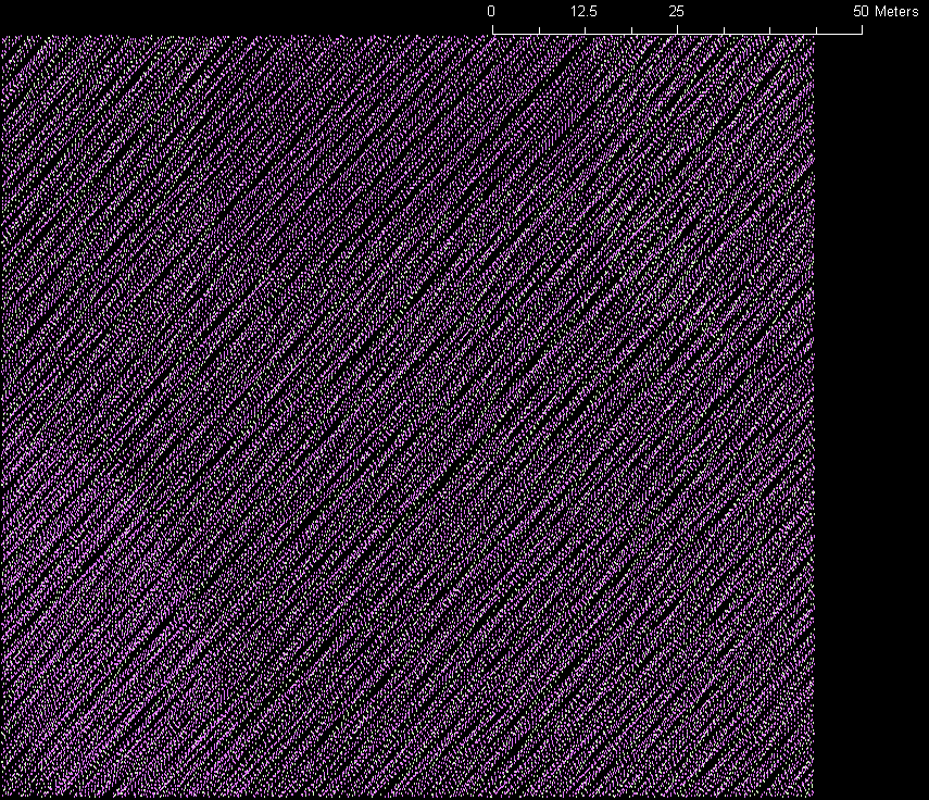
Figure 2 shows the shot density for the 1233 survey. It varies from 0.3 to 6 shots per square meter where non zero. The gaps of zero coverage (between swaths) in the northwest are as much as 80 m wide. The highest densities are in swath overlap areas (typically 2 to 3 m-2), while single swaths have densities of about 1 m-2 typically.
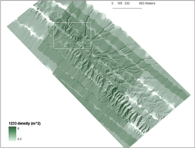
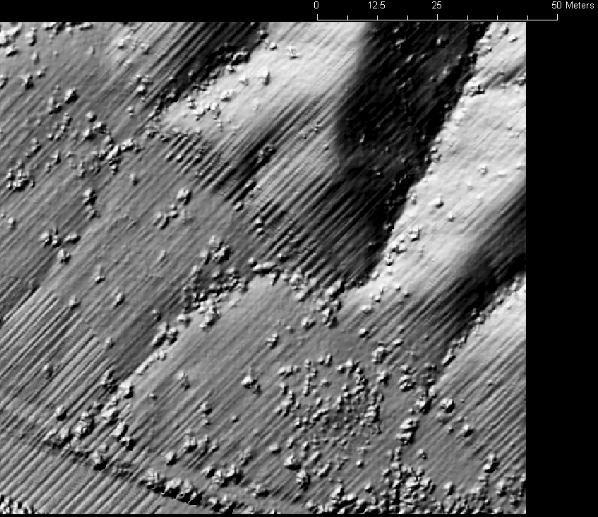
Figure 2. 1233 shot density is as high as 6 shots per square meter. The white square indicates the location of the detailed example area for the other plots (see figure 3). Here the density map is semi-transparent over the hillshade of the local maximum DEM.
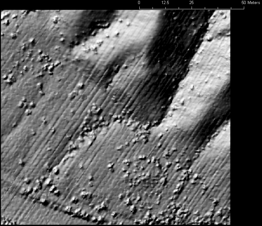
Figure 3 shows a zoom to the white rectangle in the northwestern portion of the coverage. Here, most of the area is covered by at least two swaths. and so the shot densities are 2-3 m-2.
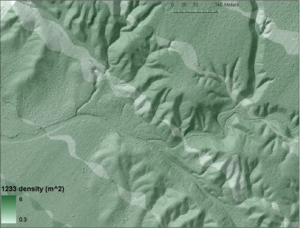
Figure 3. 1233 shot density in the northwest (see white square in figure 2). Here the density is semi-transparent over the hillshade of the local maximum DEM and the San Andreas Fault cuts across the image diagonally northwest to southeast.
5100 data
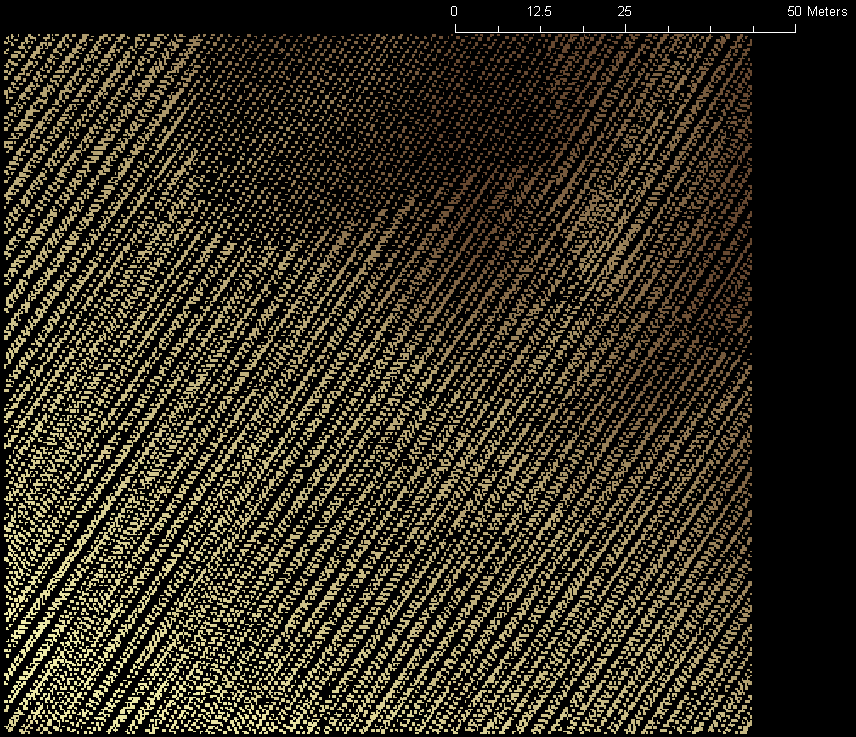
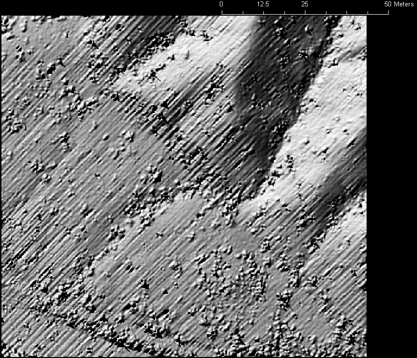
In the Geon Lidar Workflow Dragon's Back dataset we have 15,314,150 points from the 5100 scanner. Figure 4 shows the 5100 shot density in the same area as is shown for the 1233 data in Figure 2. It ranges up to 10.5 shots per square meter in a total of 5 swaths. The total survey width is 1300 m and individual swaths are about 440 m wide. Figure 5 shows the details in the same area as Figure 3.
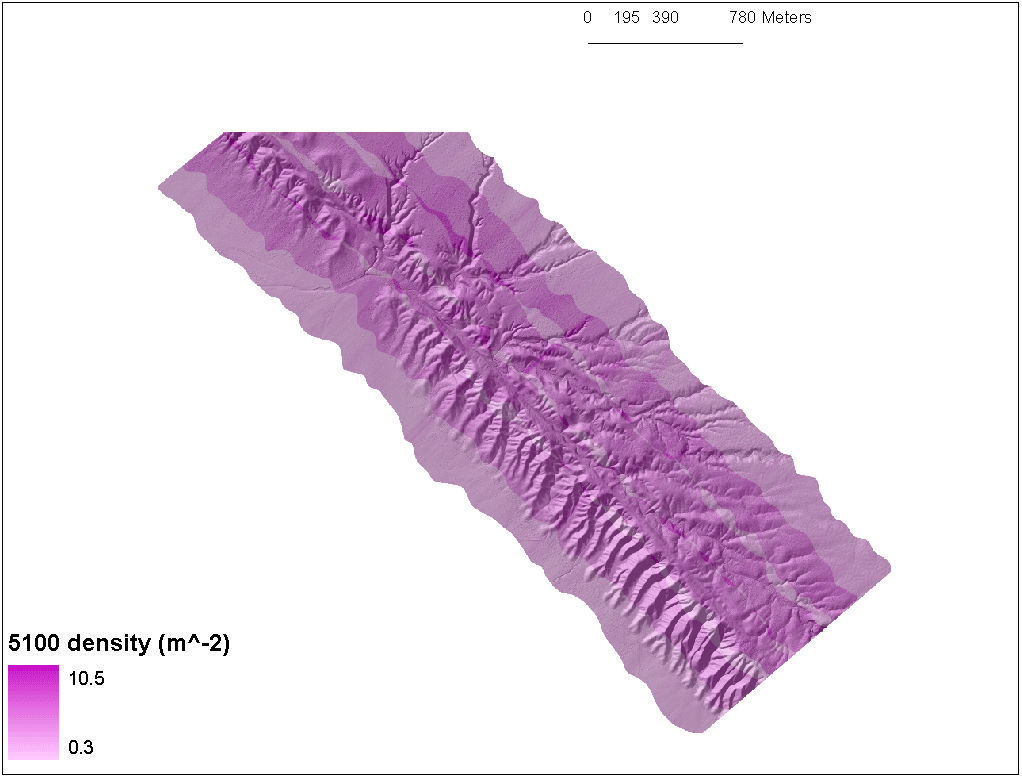
Figure 4. 5100 shot density is as high as 10.5 shots per square meter. The coverage area is the same as is shown in Figure 2. Here the density map is semi-transparent over the hillshade of the local maximum DEM.
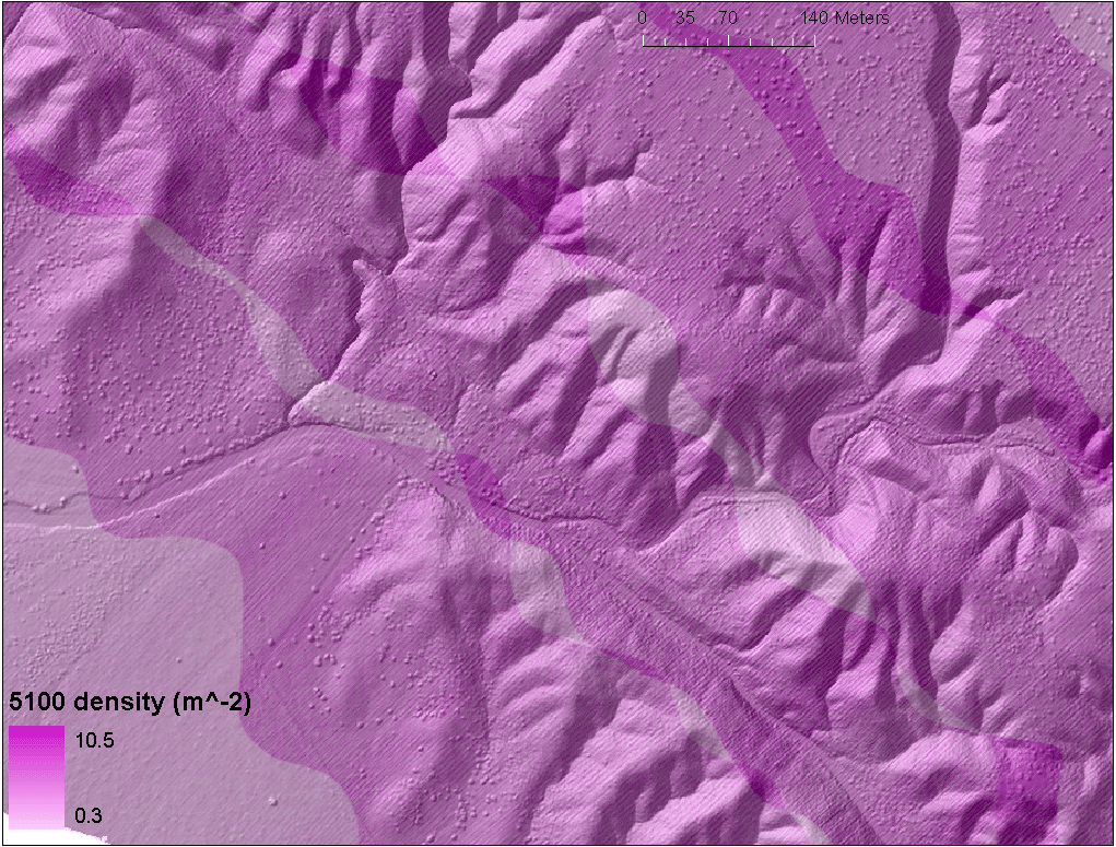
Figure 5. 5100 shot density in the northwest (see white square in Figure 2). Here the density is semi-transparent over the hillshade of the local maximum DEM and the San Andreas Fault cuts across the image diagonally northwest to southeast.
Assessment
Introduction
Both the 1233 and 5100 data sets are really incredible in terms of their depiction of the landscape. Assessing their quality is tricky without a lot of effort. The hillshades of DEMs produced from them look good and are excellent for qualitative to semi-quantitative work such as mapping, landscape visualization, and offset calculations (Figure 6). The DEMs will have to be cleaned with nulls and pits filled before they can be used for more quantitative geomorphic studies such as those in which we might compute slope versus contributing area for the areas. I have not yet done that work and assessed the resulting DEMs. I don't think it will make a big difference as long as there are no major pits or holes. A typical concern for the DEM quality that can be assessed qualitatively is the presence of "corduroy"--the rows of slightly higher and lower elevations (a few 10s of cm difference) from mislocation (elevation?) of overlapping scan lines. It is not very evident in the 1 m DEMs. But, it is quite evident in 25 cm DEMs, because the typical scanline spacing for a single swath (at least in the 5100 data) is about 35 cm.
Comparisons of 1 m DEMs
| Scanner | Zmax | Zmean | Zmin |
|---|
| 1233 | 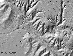 |  | 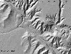 |
| 5100 | 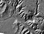 |  |  |
1233 DEM -
5100 DEM | 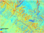 | 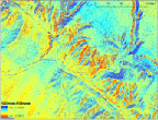 | 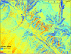 |
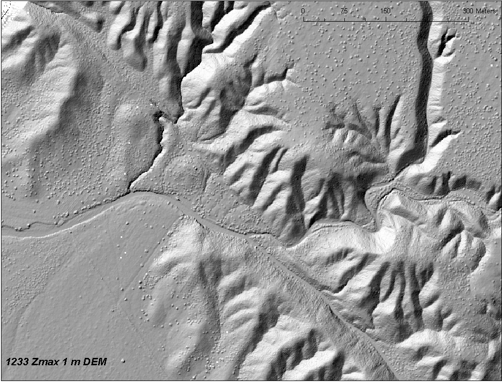
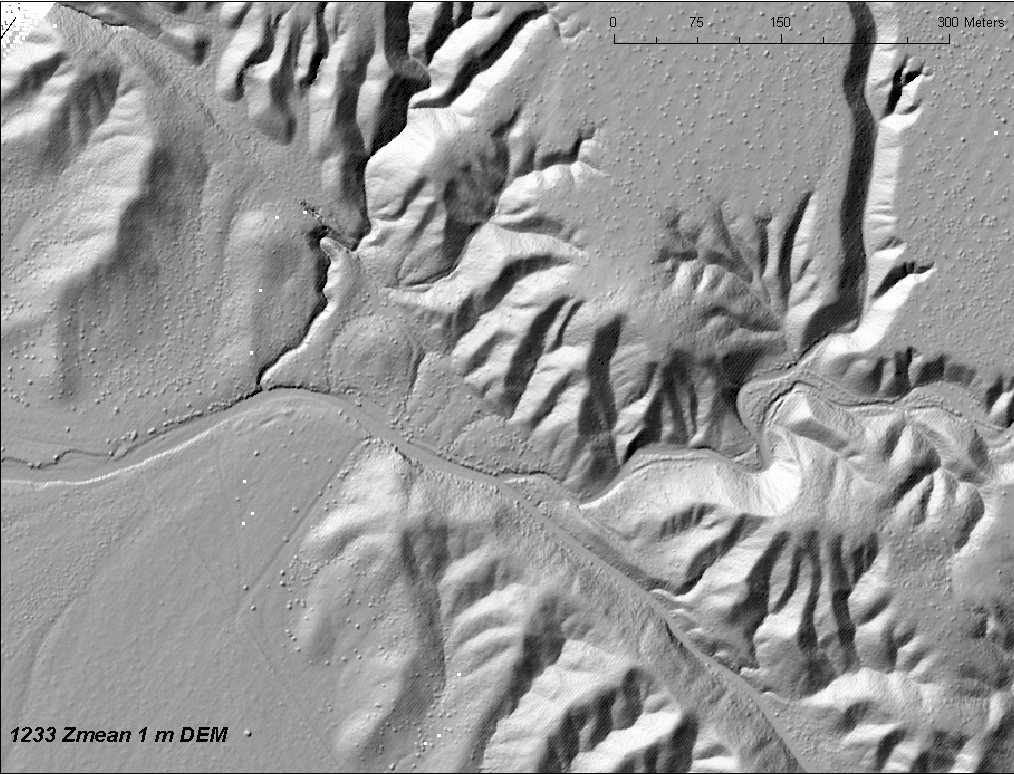
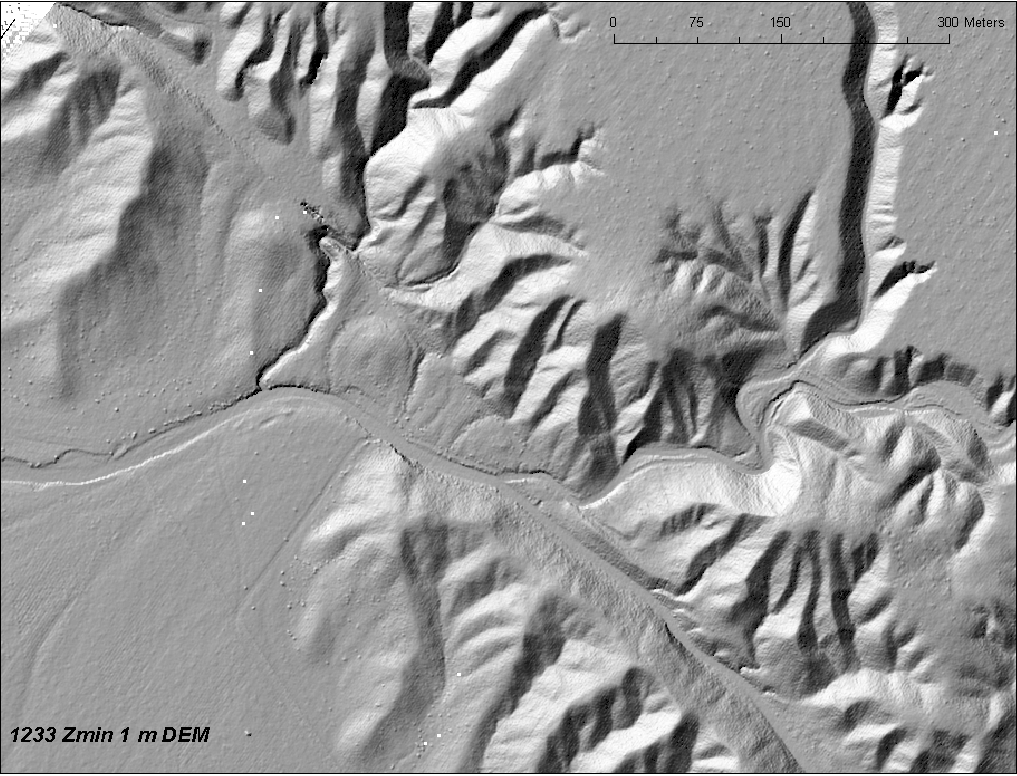
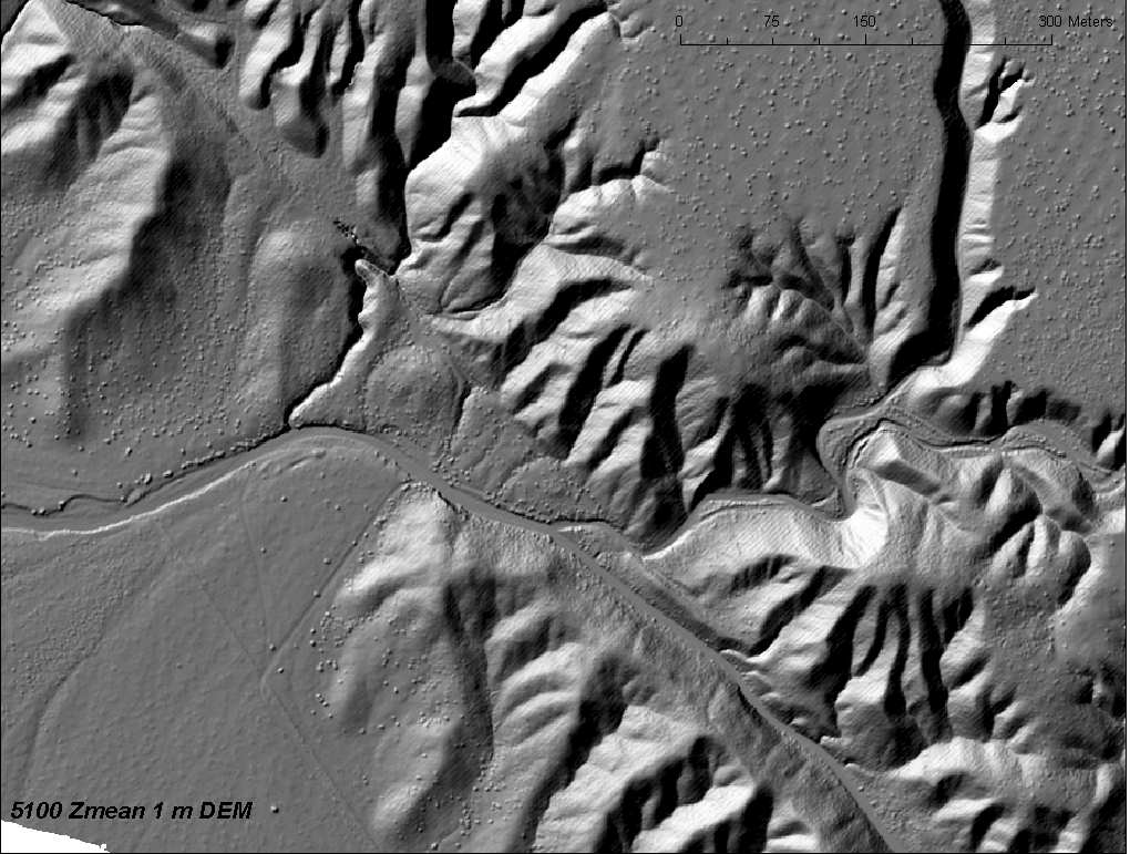
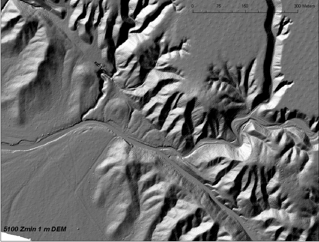
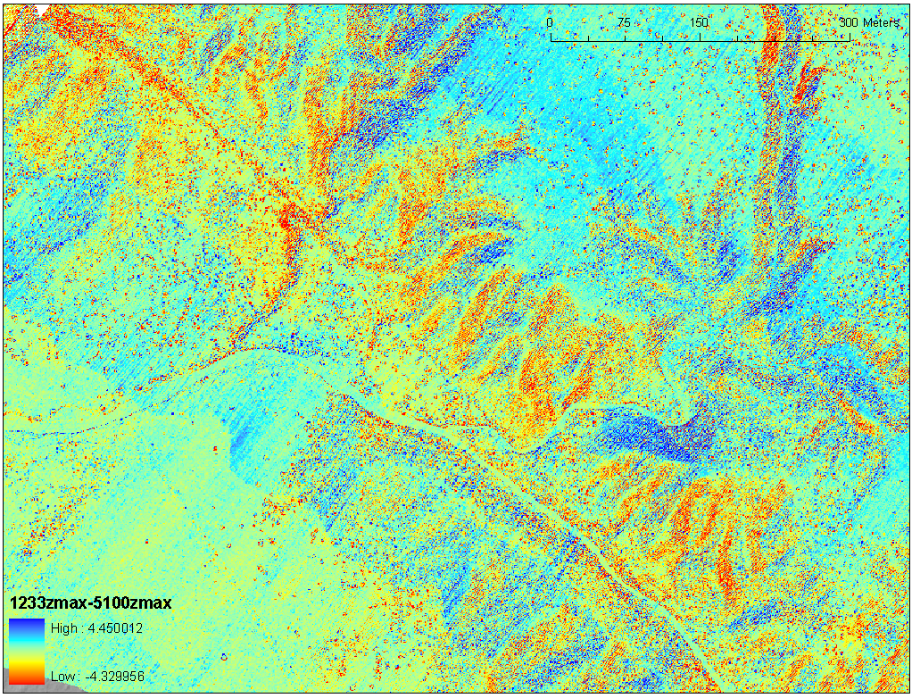
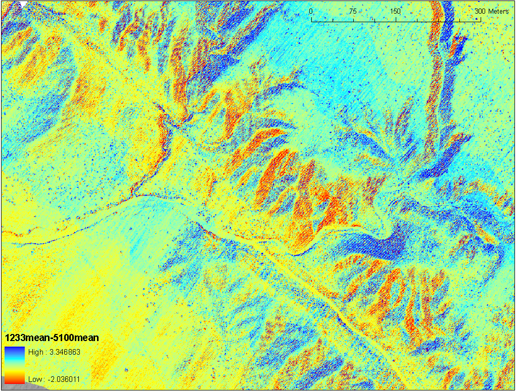
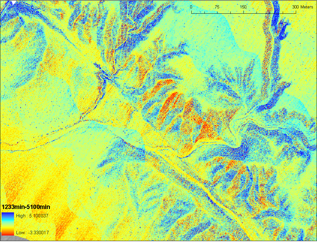
Figure 6. Comparisons of 1 meter DEMs computed from the 1233 and 5100 scanners for local maxima, mean, and minima values. The lower row shows their differences.
Figure 6 shows DEMs computed with the different local algorithms. Aside from the tonal difference between them, there are modest differences in landscape representation. I notice a slightly richer depiction of the meter scale vegetation and landforms in the 5100 1 m DEM. The corduroy appears to be a bit stronger in the 5100 data. There are a few empty cells in the 1233 data (white cells). The lowermost row of Figure 6 was determined by subtracting the 5100 dem from the 1233 dem (for the same local binning algorithm). The differences are +/-several m at most. But, much of the error appears to be from mislocation horizontally. Note for example, the lower center of the image in which a north facing slope of the major channel is consistently higher in the 1233 data. Similarly, the southeast facing slopes in the image have negative differences. Both aspect-dependent and swath parallel differences imply that the 1233 data are shifted to the northwest by about 5 m (i.e., what horizontal offset of a 37 degree slope will give a 4 m vertical error?).
Comparison of 0.25 m DEMs
While the 1 m DEMs were similar, the 0.25 m DEMs start to show the effects of the increased density of the 5100 data. For a small (approximately 100 m on a side area within the area of Figures 3 and 5), I produced views that show the actual points to directly compare the 1233 and 5100 scanners (Figure 7). There are 22,949 1233 points and 49,484 5100 points covering the site implying that the 5100 data are more than twice as dense.
| 1233 | 5100 | Combined | Zoom combined |
|---|
 |  | 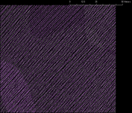 | 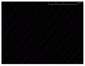 |
Figure 7. Comparisons of shot densities for the two scanners (1233 green and 5100 magenta) over a 104 m2 area in the northwest of figures 3 and 5. There are about twice as many 5100 shots as from the 1233 in this area.
For the 0.25 m grid, about half of the cells had no shots in them, requiring that I use an interpolation rather than binning method to produce a complete DEM. Figure 8 shows an exploration of the DEMs that I produced. In all cases, the 5100 data were processed to make better DEMs: the intricacy of the actual vegetatation and small landforms in these sites is more clear with those higher density data. The corduroy, however, is more evident in the 5100 grids; this is partially because there are more data. The 5100 corduroy is produced in this case by a mismatch in local elevation of 10-20 cm between adjacent scan lines from different swaths (flightlines). The scan lines are separated by 30--100 cm, so with grid resolutions at 25 cm, the algorithms will certainly "see" the different elevations of the adjacent scanlines, and thus the corduroy. Adjacent 1233 scans from different swaths are more on the order of a meter apart. They are also 10-20 cm (although might be smaller--5-15 cm--could be tested with more work) different in elevation.
In general the scanline spacing from different swaths is a few tens of decimeters, so DEMs with resolutions or search radii really less that that will have the strongest corduroy. But, the scanline distribution is more complicated than simply alternating swath coverage, and so I think at times, there are zones of successive scanlines from a single swath that are fairly closely spaced for a meter or more, and thus even one meter DEM resolution/search radii will still have that broader corduroy.
A way to rectify the corduroy is to displace one of the swaths so that it matches a reference swath. Note that the difference in reference position for each swath is due to GPS location error in horizontal and vertical directions (recall above example from figure 6 in which a horizontal difference in reference position results in a systematic vertical error between the surveys). So, one has to possibly iteratively displace the reference position (all data from a swath) and minimize the swath to swath error, but realizing that we don't really know what is the correct reference position, because we cannot be sure that we are measuring the same position on the earth each time. The GPS error apparently has a wavelength in time of several minutes and amplitude of a few dm, so that converts to a few dm over a few km variation (M. Bevis, personal communication, 2006). Thus, this adjustment has to be done in either a piecewise manner (likely to induce steps if the study area is broader than a few km), or progressively to smoothly adjust the swaths. In the case of the B4 dataset, this has not been desireable because the original plan for the data was to maintain its absolute position quality (lost if we do relative corrections of the data as discussed above) for geodetic purposes. So, the alternative for cleaning up the cordoroy is to improve the GPS positioning.
| Scanner | Zmax (local binning) | ArcGIS Krig | ArcGIS spline | GLW spline |
|---|
| 1233 | 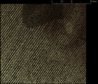 | 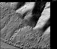 | 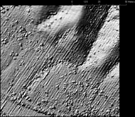 | Not available |
| 5100 | 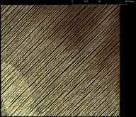 | 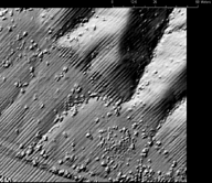 |  | 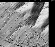 |
Figure 8. Comparisons of 0.25 meter DEMs computed from the 1233 and 5100 scanners for local maxima binning, ArcGIS Krig and spline, and the GEON Lidar Workflow (GLW; http://www.geongrid.org/science/lidar.html) spline.