Home
Current Research
OpenTopography Portal
LViz: 3D LiDAR Visualization Tool
Points2Grid: LiDAR DEM Generation Tool
Data
Knowledge Base
Links
LiDAR LISTSERV
Active Tectonics Research Group


Utilization of LiDAR point cloud data for tectonic geomorphology and faulting studies:ABSTRACTS:Crosby, C.J. and Arrowsmith, J R., Utilization of LiDAR / ALSM Point Cloud Data for Earthquake Geology and Tectonic Geomorphic Mapping, Analysis, and Visualization, Presented at the 100th Anniversary Earthquake Conference, San Francisco, CA April 18-21, 2006. 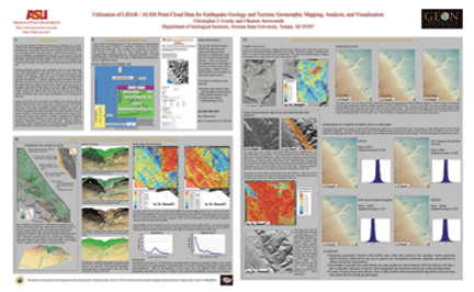 Download the fullsize poster (63 MB PDF) Arrowsmith, J R. and Crosby, C.J., New Looks at Active Faults: Tectonic Geomorphology using Airborne Laser Swath Mapping (ALSM), Presented at the 100th Anniversary Earthquake Conference, San Francisco, CA April 18-21, 2006. Download the slides from this talk (~62 MB PowerPoint) |
