Home
Current Research
OpenTopography Portal
LViz: 3D LiDAR Visualization Tool
Points2Grid: LiDAR DEM Generation Tool
Data
Knowledge Base
Links
LiDAR LISTSERV
Geoinformatics @ ASU
Active Tectonics Research Group


|
LViz - LiDAR / ALSM 3D Visualization tool
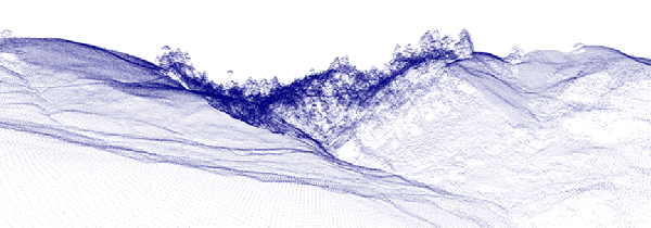
LViz is a tool developed by Jeffrey Conner in the Active
Tectonics Research Group at Arizona State University. Designed
for 3D visualization of LiDAR / ALSM point and interpolated data,
the tool offers import of LiDAR point cloud data (delimited text file)
or interpolated surfaces (in ascii or arc ascii grid formats). LViz
also offers texture mapping and user control over display settings
such as data and background color. LViz was originally written for
visualization of outputs from the GEON
LiDAR Workflow (GLW) (additional GLW information here)
and is designed to run on Windows platforms. Although originally conceived
for the 3D visualization of LiDAR data, LViz can be used to view any
3D point cloud data such as seismicity or gravity.
LViz is an evolving piece of software, new versions will be released
periodically (see below for most recent version).
LViz Users Guide
New Features in LViz Version 1.4.1.1:
- Import of files with a column header and the ability to specify
which column to use for x, y, and z coordinates.
- Color points based upon an attribute in a 4th column. This feature
is currently only implemented to work for classified return data
with values of G (ground), V (vegetation) and S (structure). Point
symbolization by attribute will be fully implemented in the next
version of LViz.
- Updated "How-To" file in the zip.
Previous Versions:
LViz Version 1.2.0:
- Multiple layer import is now supported. Up
to 4 layers of any supported type can be imported and displayed
simultaneously.
- Added lighting and shading to interpolated
layers when displayed in polygon mode.
- Combined Grid and Arc ascii imports. LViz will
now automatically detect which one is being imported.
- Updated settings menu. Settings can now be
changed for each layer.
- Added layer menu to allow user to toggle the
visibility of the imported layers.
LViz Version 1.1.1:
- LViz is now protected under the GNU General Public License - information can be found in the "About LViz..." dialog under the help menu.
- Background default set to white
- Comma added as a default on import point cloud option
- Import Arc ASCII routines added
- Import Grid ASCII routine renamed
- Error checking added so that if a user selects Grid on the import Arc ASCII an error message will appear (and vice versa).
- Fixed issue where squares on ASCII imports weren't connected properly to each other
- Added "Controls" dialog to the help menu
|
|
