Home
Current Research
OpenTopography Portal
LViz: 3D LiDAR Visualization Tool
Points2Grid: LiDAR DEM Generation Tool
Data
Knowledge Base
Links
LiDAR LISTSERV
Active Tectonics Research Group


LiDAR Data Distribution and Processing with GEON Cyberinfrastructure:
Using cyberinfrastructure available via the GEON Project, we have built an interactive online tool set that offers distribution of LiDAR / ALSM point cloud data, digital elevation model (DEM) generation and calculation of a variety of derived products - the GEON LiDAR Workflow (GLW). The GLW is a product of collaboration between the Active Tectonics Research Group at ASU and colleagues at the San Diego Supercomputer Center as part of the GEON project. The goal of this project is to build a cyberinfrastructure-based resource to enable access to massive and computationally challenging LiDAR point cloud datasets. The GLW facilitates user interaction with these datasets by leaving the difficult processing tasks to the distributed computational resources available through the GEON Grid. Ultimately, we hope that this tool will democratize access to these very powerful data sets. We believe that this approach to LiDAR data handling and analysis represents a cutting-edge example of the application of cyberinfrastructure to next generation earth science datasets. By facilitating access to these powerful datasets, the GLW is enabling new earth surface processes research. The GEON LiDAR Workflow is currently online and is available as a beta-release to users via the GEON Portal. We are actively working to refine the workflow, improve performance, expand functionality, add datasets and polish the user interface. LiDAR DATASETS CURRENTLY AVAILABLE VIA THE GLW:
PUBLICATIONS: Efrat Jaeger-Frank, Christopher J. Crosby, Ashraf Memon, Viswanath Nandigam, J. Ramon Arrowsmith, Jeffery Conner, Ilkay Altintas, Chaitan Baru, A Three Tier Architecture for LiDAR Interpolation and Analysis, Lecture Notes in Computer Science, Volume 3993, Apr 2006, Pages 920-927, DOI: 10.1007/11758532_123. Crosby, C.J., C.J.Conner, J., Frank, E., Arrowsmith, J R., Memon, A., Nandigam, V., Wurman, G., Baru, C., A Geoinformatics Approach to LiDAR Data Distribution and Processing: in preparation RECENT ABSTRACTS: Crosby, C.J., Arrowsmith, J R., Frank, E., Nandigam, V., Kim, H.S., Conner, J., Memon, A., Baru, C., Enabling Access to High-Resolution LiDAR Topography through Cyberinfrastructure-Based Data Distribution and Processing, The Annual Meeting of the American Association of Geographers, Abstract of 103rd Annual Meeting, San Francisco, CA, 2007. Crosby, C.J., Arrowsmith, J R., Frank, E., Nandigam, V., Kim, H.S., Conner, J., Memon, A., Baru, C., Enhanced Access to High-Resolution LiDAR Topography through Cyberinfrastructure- Based Data Distribution and Processing, Eos Trans. AGU, 87(52), Fall Meet. Suppl., Abstract IN41C-04, 2006. [Slides from this talk - 5.4 MB] Kim, H., Arrowsmith, J R., Crosby, C.J., Jaeger-Frank, E., Nandigam, V., Memon, A., Conner, J., Badden, S.B., Baru, C., An Efficient Implementation of a Local Binning Algorithm for Digital Elevation Model Generation of LiDAR/ALSM Dataset, Eos Trans. AGU, 87(52), Fall Meet. Suppl., Abstract G53C-0921, 2006. [PDF of poster - 21.6 MB] Crosby, C.J., Arrowsmith, J.R., Baru, C., Meertens, C., 2006, A National Framework For Community LIDAR Datasets, Geological Society of America Abstracts with Programs, Vol. 38, No. 7, p. 550 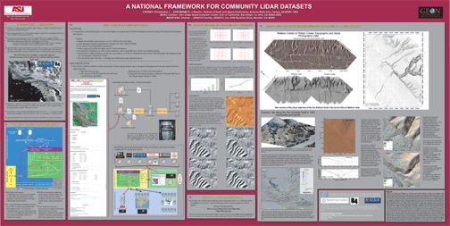 Crosby, C.J., Arrowsmith, J R., Conner, J., Frank, E., Memon, A., Nandigam, V., Wurman, G., Baru, C., A geoinformatics-based approach to the distribution and processing of integrated LiDAR and imagery data to enhance 3D earth systems research, Presented at the Geological Society of America Penrose Conference: "Unlocking 3D Earth Systems — Harnessing New Digital Technologies to Revolutionize Multi-Scale Geologic Models", Durham, UK, September, 2006. [PDF of Presentation] Crosby, C.J., Arrowsmith, J R., Frank, E., Nandigam, V., Kim, H.S., Conner, J., Memon, A., Baru, C., An Internet-based Tool for Accessing and Processing the Southern San Andreas (B4) LiDAR / ALSM Dataset, Southern California Earthquake Center Annual Meeting, Proceedings and Abstracts, v. 16, Palm Springs, CA, September, 2006. 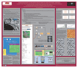 Crosby, C.J., Conner, J., Frank, E., Arrowsmith, J R., Memon, A., Nandigam, V., Wurman, G., Baru, C., The GEON LiDAR Workflow: An Internet-Based Tool for the Distribution and Processing of LiDAR Point Cloud Data, in: Brady, S.R., Sinha, A.K., Gundersen, L.C., Geoinformatics 2006—Abstracts, U.S. Geological Survey Scientific Investigations Report 2006-5201. [Slides from this talk] [Archived Webcast] Crosby, C.J., Conner, J., Frank, E., Arrowsmith, J R., Memon, A., Nandigam, V., Wurman, G., Baru, C., The GEON LiDAR Workflow: An Internet-Based Tool for the Distribution and Processing of LiDAR Point Cloud Data, 2006 UNAVCO Science Workshop, Denver, CO. Crosby, C.J., Conner, J., Frank, E., Arrowsmith, J R., Memon, A., Nandigam, V., Wurman, G., Baru, C., A Geoinformatics Approach to LiDAR / ALSM Data Distribution, Interpolation, and Analysis, Eos Trans. AGU, 86(52), Fall Meet. Suppl., Abstract H31E-1349, 2005. 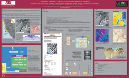 RECENT PRESENTATIONS: Arrowsmith, J R., Crosby, C.J., Frank, E., Memon, A., Nandigam, V., Wurman, G., Baru, C., Conner, J., Kim, H.S., GEON LiDAR Workflow for B4 data access, Presentation at the Southern San Andreas Fault Evaluation (SoSAFE) Project Workshop, January 8, 2007. (~35 MB ppt) Crosby, C.J.Conner, J., Frank, E., Arrowsmith, J R., Memon, A., Nandigam, V., Wurman, G., Baru, C., The GEON LiDAR Workflow: An Internet-Based Tool for the Distribution and Processing of LiDAR Point Cloud Data, Invited presentation at LiDAR Imagery workshop at USGS, Pasadena, CA office, June 7th, 2006. (~20 MB ppt) Crosby, C.J., Conner, J., Frank, E., Arrowsmith, J R., Memon, A., Nandigam, V., Wurman, G., Baru, C., The GEON LiDAR Workflow: An Internet-Based Tool for the Distribution and Processing of LiDAR Point Cloud Data, "LiDAR Data: Management, Processing, and Access" Special Interest Group, 2006 UNAVCO Science Workshop, Denver, CO. (~10 MB PowerPoint) Related Information:
|
