Home
Current Research
OpenTopography Portal
LViz: 3D LiDAR Visualization Tool
Points2Grid: LiDAR DEM Generation Tool
Data
Knowledge Base
Links
LiDAR LISTSERV
Active Tectonics Research Group


LiDAR / ALSM Knowledge BaseDOCUMENTS: Points2Grid Instructions / Help document (pdf) Resarch Summary: "An Efficient Implementation of a Local Binning Algorithm for Digital Elevation Model Generation of LiDAR/ALSM Datasets" Exploration of search radius for GEON LiDAR Workflow Consideration of point count and optimal resolution and search radius for B4 ALSM data in the Carrizo Plain Comparison of data acquired by the Optech 1233 and 5100 ASLM scanners for a portion of the Southern San Andreas fault Analysis of LiDAR shot densities for NCALM Eastern California Shear Zone (ECSZ) survey and B4 Notes on LiDAR DEM Generation via Local Interpolation Methods (pdf) Early notes on different interpolation methods (pdf) Notes on Luke Wash Lidar Survey (pdf) KMZ file of 10 foot LiDAR-derived DEM Instructions for Running Interp (Linux version of P2G) on Raw Data Files (doc) Analysis of overlapping LiDAR swaths see also blog entry. Simple AWK command to clean a point cloud text file: awk -F"," '{OFS=","}{if ($1 != strnum && $2 != strnum && $3 != strnum) print $1" " $2" " $3 }' 12525122622711892399111.txt > 9111clean.txt (also checks to make sure the elements are actual numbers) Exploring the new Open Topography Points 2 Grid with null filling Comparing LiDAR shot counts: GeoEarthScope, ECSZ, and B4 surveys TRAINING COURSES: 2009: Using EarthScope and B4 LiDAR data to analyze Southern California's active faults - Sponsored by SCEC, OpenTopography, UNAVCO, and SDSC 2007 Geological Society of America Short Course: Processing and Analysis of GeoEarthscope and Other Community LiDAR Topography Datasets 2006 UNAVCO Science Workshop LiDAR Special Interest Group: LiDAR Data: Management, Processing, and Access - presentations on LiDAR / ALSM instruments, technology, software and data access. TEACHER RESOURCES: San Diego Supercomputer Center TeacherTech Series workshop Earthquakes recorded in the landscape: Using digital topography to investigate earthquake faulting - course presented to middle and high school teachers TLS RESOURCES: TLS Point Cloud Georeferencing Utilities Analysis of TLS for paleoseismic research
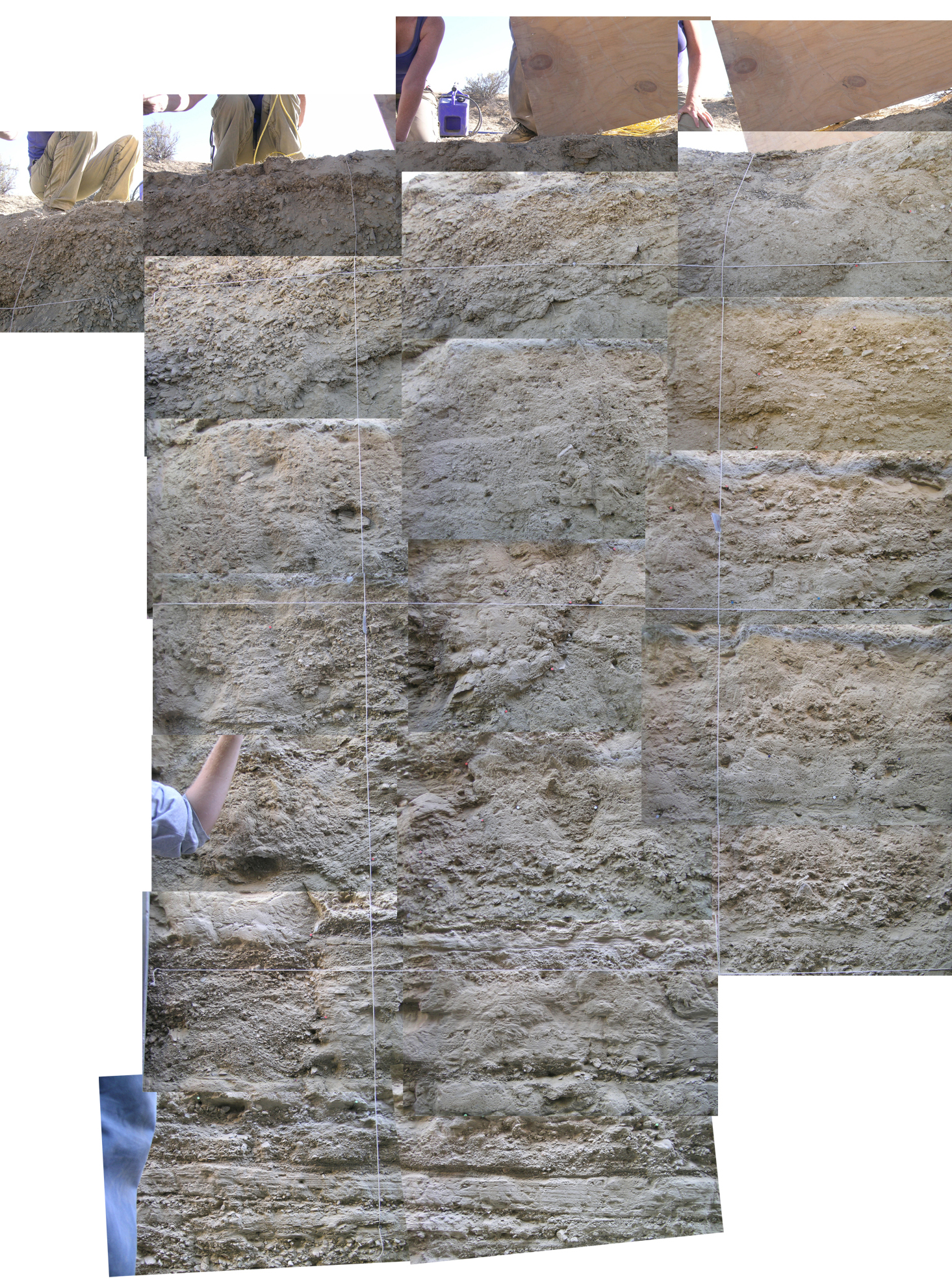
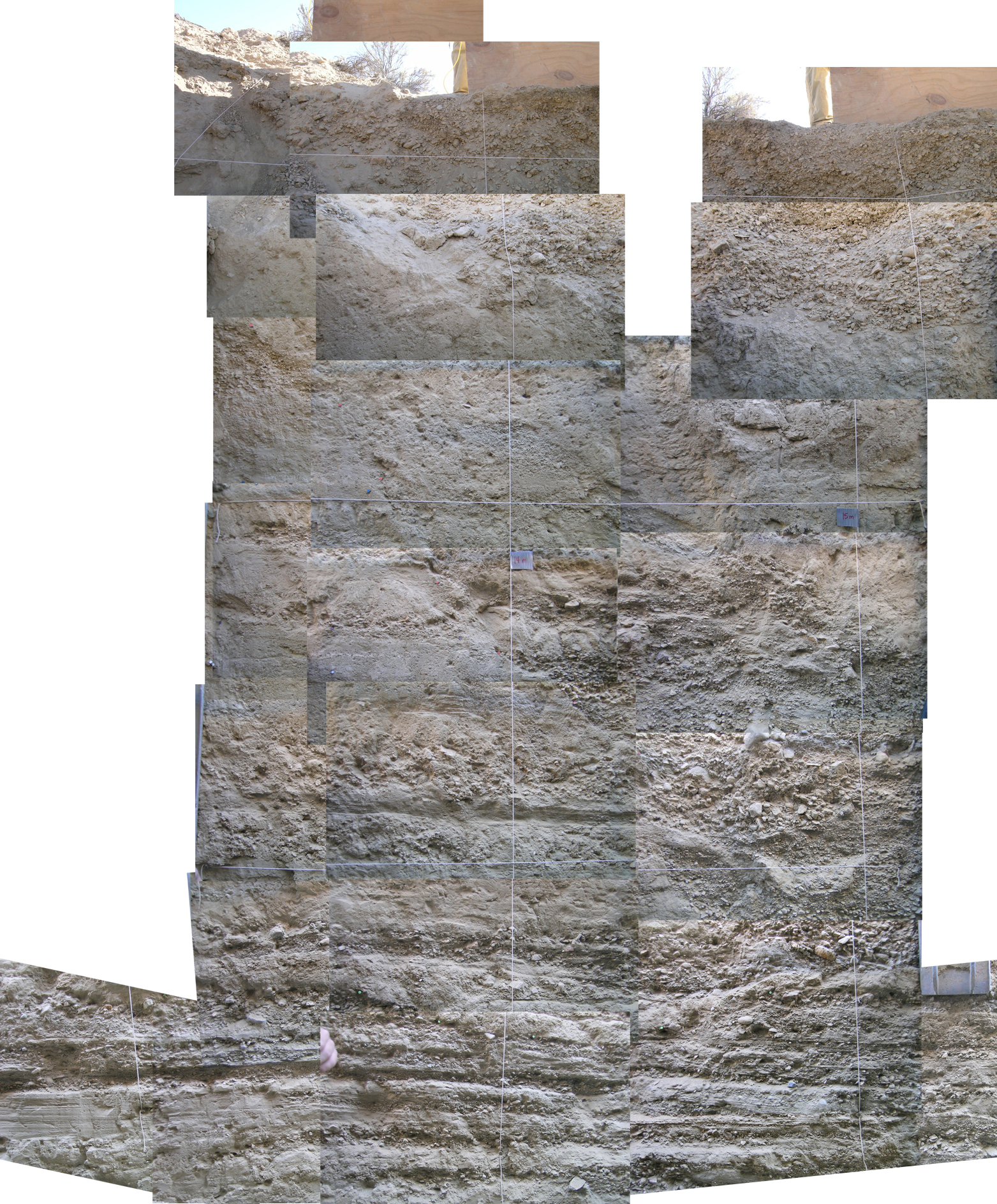
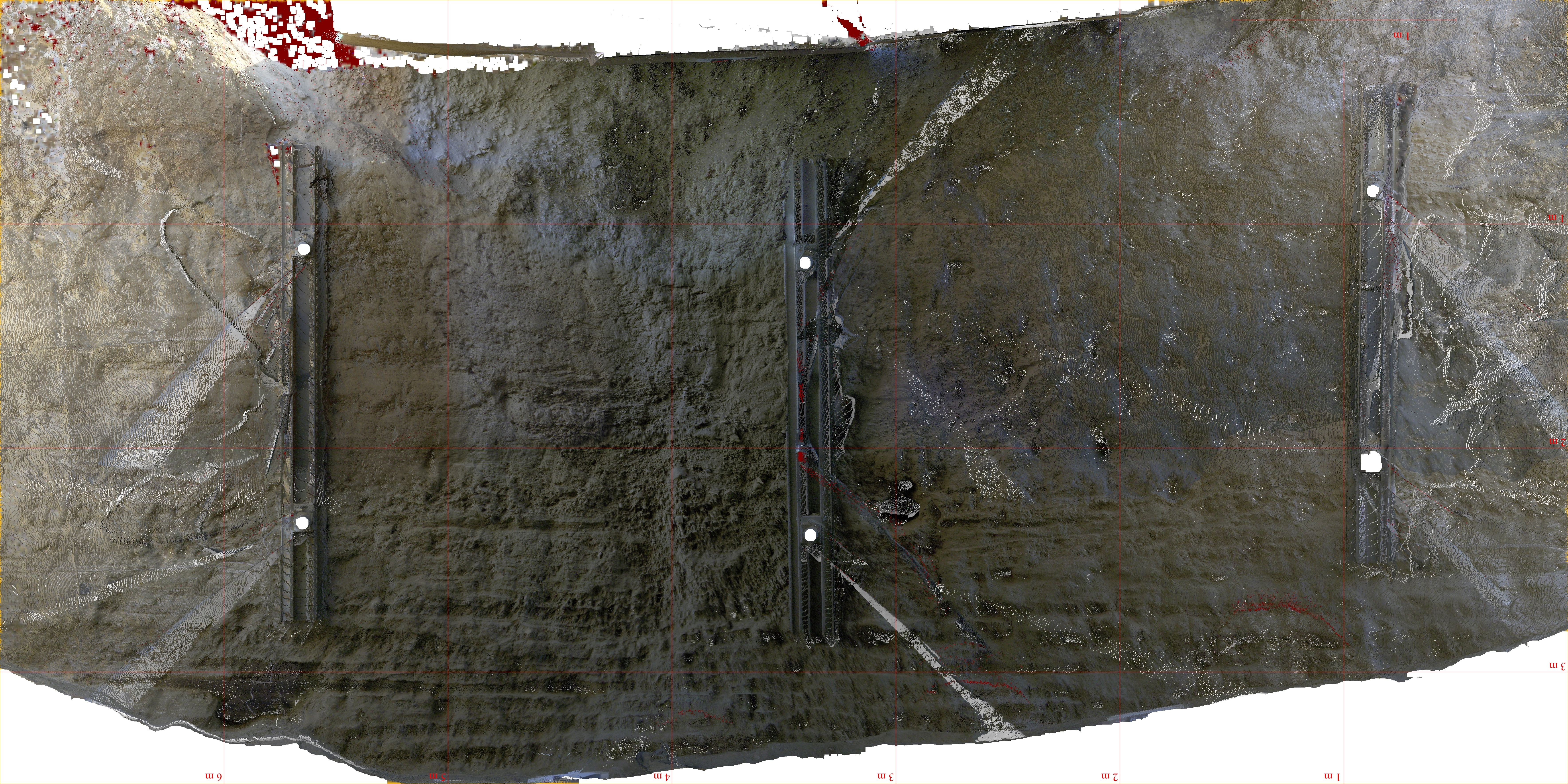
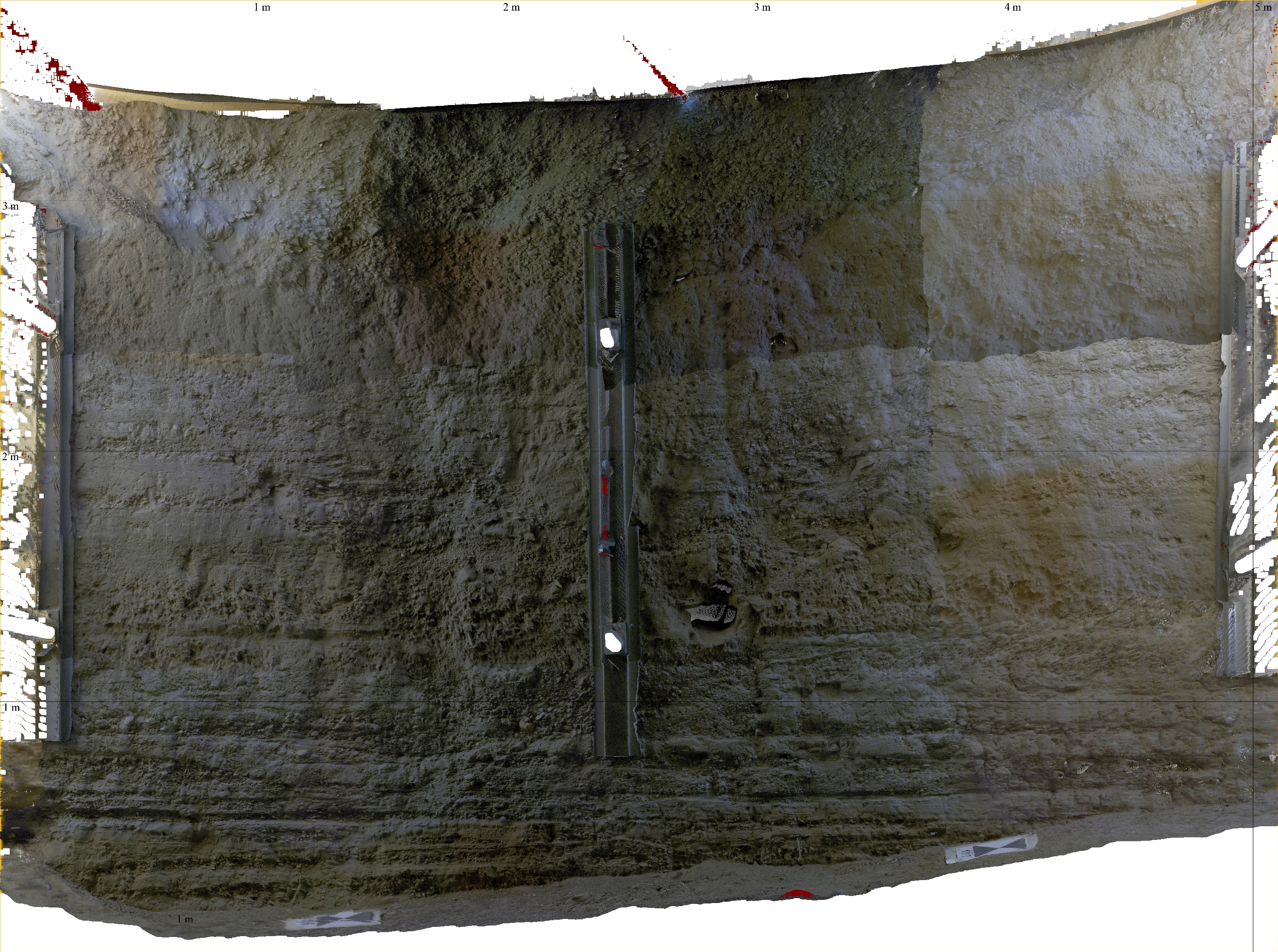
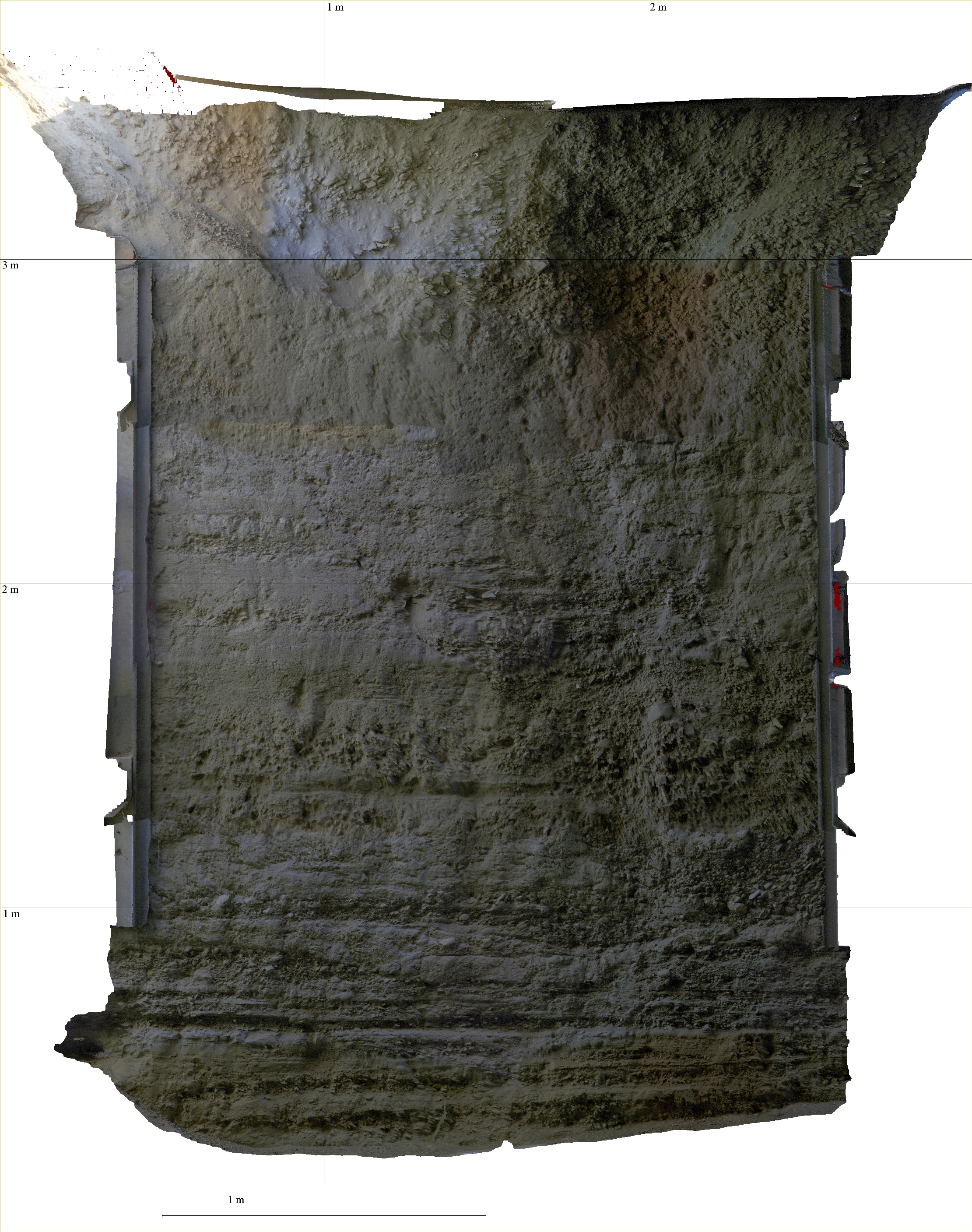
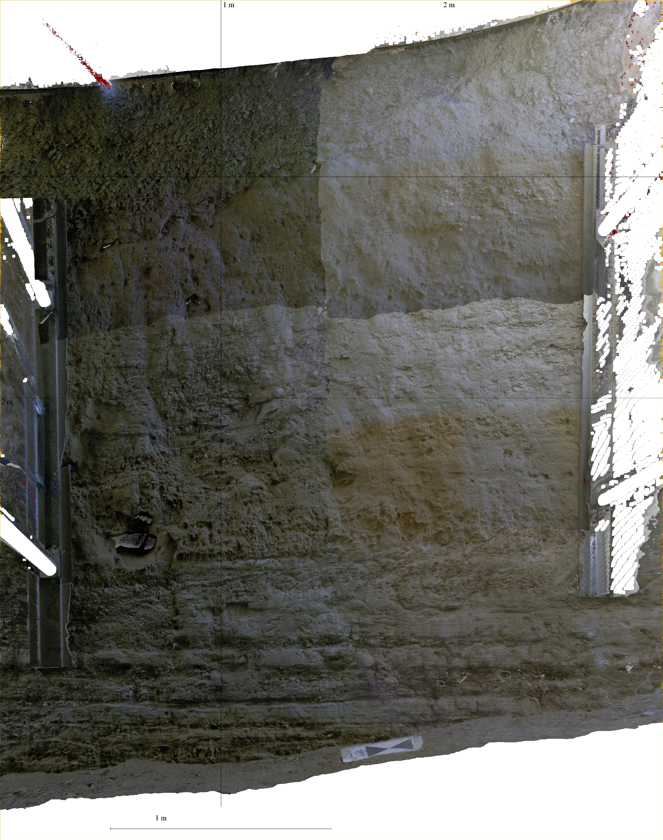
2009 AGU presentation on TLS applications for paleoseismology Documentation for the analysis of the Carrizo Plain TLS dataset (.pdf) Comparison between manually produced Trenchomatic images for T18: T18 Panel F-West Stitched and T18 Panel G West Stitched and the orthophotos pulled from the TLS scans: T18 west wall and T18 east wall Also: color and grey orthophotos of T19c: T19c north wall color and T19c north wall grey . T19c south wall color and T19c south wall grey Videos of 3D point clouds (.avi): T18: video_1 video_2 video_3 video_4 video_5 T19: video_1 video_2 T19c: video_1 video_2 video_3 video_4 Updated T18 mosaic from Z+F technician Juergen Mauer: Improved mosaic 1. Improved mosaic 2. Improved mosaic zoom to left side. Improved mosaic zoom to right side. Juergen says: "make selections in the scans that cover the area with the best detail level and only a small overlap to adjacent scans".
Analysis of TLS scanning of the Landers earthquake scarp Analysis of the Alvord Basin terrestrial LiDAR data
Utility descriptions and documentation: Utilities: A small sample of the raw dataset (.txt) Output files of the sample data after processing them with the 3-column utility script: |
